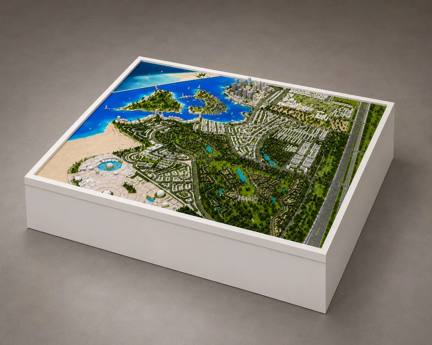
Large development projects rarely fit inside a single drawing sheet. A metro corridor, an industrial park, or a new residential sector involves dozens of interconnected elements — roads, plots, green belts, drainage, utilities — that are hard to grasp from plans alone. This is where a master plan model earns its place in almost every serious planning presentation, from municipal reviews to private investor pitches.
Why Flat Plans Fall Short
Architectural drawings communicate well to trained professionals, but most stakeholders in a large project are not architects. Landowners, government officials, financiers, and future residents all need to understand what is being proposed, and a two-dimensional layout simply does not translate into an intuitive mental picture for most people. Elevation changes, road hierarchies, and the relationship between built and open space are especially difficult to read from paper.
A physical model solves this instantly. Viewers can walk around it, look down a proposed avenue, or compare the scale of a planned tower against the surrounding low-rise development, all without needing to interpret technical notation.
What Goes Into an Accurate Master Plan Model
Building a convincing model starts with the base layout — contours, plot boundaries, and road networks are typically laser-cut or CNC-routed to match the surveyed topography. Buildings are then added as scaled massing blocks or fully detailed structures, depending on the stage of the project and how much design detail has been finalised.
Landscaping elements such as trees, water bodies, and open plazas are added toward the end, along with lighting in some cases, to give reviewers a realistic sense of how the finished development will feel rather than just how it will look from above.
Where These Models Are Used Most
Real estate developers commission a master plan model for sales galleries, where prospective buyers can see exactly where their unit sits relative to amenities, entrances, and neighbouring blocks. Government planning departments use them during public consultations and approval hearings, since a shared physical reference reduces disputes about what was actually proposed.
Infrastructure agencies building highways, ports, or transit corridors also rely on these builds to coordinate between multiple contractors working on different sections of the same project, ensuring everyone is working from the same physical understanding of the layout.
Scale, Size, and Level of Detail
The right scale depends entirely on how the model will be used. A model destined for a permanent sales office might be built at a larger scale with fine architectural detailing, while one meant for a single government hearing could be simpler and more compact for easy transport. Discussing intended use with the model-making studio early on avoids costly rework later.
Modularity is worth considering too. Many large projects are phased over several years, and a model built in interlocking sections can be updated or expanded as new phases are approved, rather than being rebuilt from scratch each time.
Choosing a Studio for a Complex Build
Because these projects often involve confidential land data and evolving designs, it helps to work with a studio that has handled large civic or township projects before and understands the sensitivity around unreleased plans. Ask to see examples of previous large-format builds and confirm how revisions are handled once construction on the model has already started.
It also helps to understand how a studio sources its base data. Some rely entirely on drawings supplied by the client, while others cross-reference satellite imagery or survey data to catch inconsistencies before fabrication starts. This second layer of checking can save significant rework once the model reaches its first review meeting.
Timeline Expectations for a Large-Format Build
Larger master plan builds typically move through three distinct phases: a base layout and terrain stage, a structural and building placement stage, and a final detailing and landscaping stage. Each stage benefits from a client sign-off before moving to the next, since correcting a plot boundary error after landscaping has already been added is far more disruptive than catching it earlier.
Studios that break their timeline into these clear checkpoints tend to deliver more predictable results than those offering a single lump-sum delivery date with no interim review, particularly on projects where the underlying design is still being finalised alongside the model build.
Budgeting for Scale and Detail
Cost is driven primarily by footprint size, level of architectural detail, and whether landscaping or lighting is included. It is often more cost-effective to build a smaller, highly detailed model of the most important zone — a central plaza or flagship tower cluster, for instance — than to build an entire project at uniform detail across every section.
Discussing budget constraints openly with the studio at the outset usually leads to a better outcome than trying to specify every detail first and negotiating price afterward, since experienced studios can often suggest where detail matters most for a given audience.
A Long-Term Presentation Asset
A well-executed master plan model becomes more than a presentation piece — it often ends up as the reference point that different teams return to throughout the life of the project, long after the original pitch meeting is over. Sales teams, planning departments, and construction coordinators all tend to find their own uses for the same physical build over the years that follow.
Coordinating Between Multiple Design Teams
Large developments often involve separate architects for different building types, a landscape consultant for open spaces, and a traffic engineer for road networks, each producing drawings independently. A physical scale build forces all of this information into one coherent whole, which frequently surfaces small inconsistencies between drawing sets — a road width that does not quite match, or a plot boundary that shifted slightly between revisions — before they become expensive problems on site.
Project managers who bring a model into coordination meetings early tend to catch these conflicts at a stage where correcting them is simply a matter of updating a drawing, rather than a matter of reworking something already under construction.
Presenting to Non-Technical Stakeholders
Government approval committees, community consultation panels, and financial investors rarely include people trained to read architectural drawings fluently. A model removes that barrier and allows the actual merits of a design to be evaluated, rather than the presentation being derailed by confusion over what a particular line or shading pattern on a drawing represents.
This is particularly valuable during public consultation processes, where clear communication can meaningfully affect how a project is received by the surrounding community and, in turn, how smoothly it moves through the approval process.